Drone Technology Strengthens India’s Heritage Protection
Industry Insights from Next Move Strategy Consulting
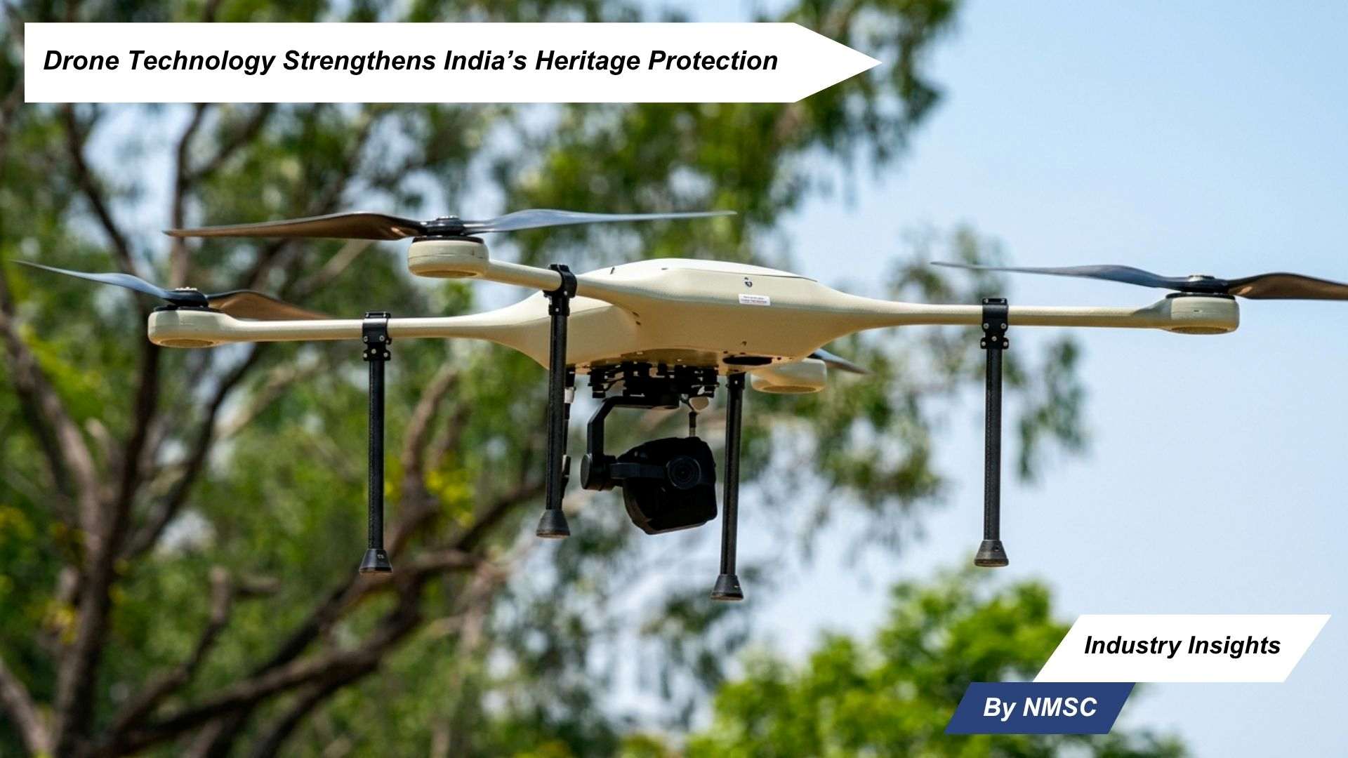
India’s adoption of drone technology in heritage conservation marks a significant advancement in the protection of its cultural landmarks. According to an official fact-sheet released on Saturday, the Archaeological Survey of India (ASI) currently safeguards 3,686 centrally protected monuments through strengthened conservation systems, scientific restoration practices, and modern technologies such as drones and Artificial Intelligence (AI).
The country’s expanding cultural stature is further reflected in its 44 UNESCO World Heritage Sites, including the recent addition of the Maratha Military Landscapes. This growing global recognition underscores the importance of modernising preservation frameworks to ensure long-term sustainability of India’s historical assets.
A New Era of Heritage Documentation
Conservation methods in India are evolving beyond traditional approaches. Authorities are increasingly integrating advanced aerial and digital technologies to improve the accuracy, speed, and depth of monument assessment. Drone-based surveys, LiDAR scanning, GIS-based mapping, and photogrammetry are now being deployed as required for precise documentation and proactive conservation planning.
These tools enable detailed recording of structures, terrain, and surrounding environments while reducing dependency on time-intensive manual inspections. By generating high-resolution data and spatial insights, drones are helping conservation teams make more informed restoration decisions.
Key Capabilities Driving Preservation Efforts
-
Drone-Based Surveys: Used for aerial imaging, topographical analysis, and rapid site assessments, drone surveys improve access to difficult or sensitive heritage locations while enhancing data accuracy.
-
LiDAR Scanning: Supports detailed structural mapping and 3D modelling, allowing experts to detect hidden or damaged architectural features.
-
GIS-Based Mapping: Provides spatial intelligence for planning, monitoring, and managing conservation zones more effectively.
-
Photogrammetry: Transforms photographs into accurate digital replicas, enabling long-term archival documentation and virtual analysis.
-
Scientific Diagnostics: Laboratory techniques are increasingly applied to study heritage materials, assess deterioration patterns, and determine the most suitable conservation treatments.
Technology Supporting Cultural Accessibility
Beyond physical conservation, digital innovation is also reshaping public engagement with heritage assets. AI-enabled platforms are being introduced to process and organise large volumes of heritage data, manuscripts, and cultural knowledge systems. These systems are also enhancing accessibility through digital interfaces and language technologies, helping wider audiences engage with India’s cultural legacy.
Collaboration Expands the Conservation Ecosystem
Drone-based surveys have also been undertaken in collaboration with institutions such as the National Institute of Science Education and Research (NISER), highlighting the growing role of scientific organisations in heritage preservation. Such partnerships demonstrate how cross-sector expertise can accelerate innovation in monument management and conservation science.
Next Move Strategy Consulting View: Drone Market Outlook
According to Next Move Strategy Consulting, the increasing use of drones in heritage conservation reflects a broader expansion of the Drone Market into high-value public sector applications. While drones are widely associated with agriculture, infrastructure, and surveillance, their role in cultural preservation is creating new demand for precision imaging, mapping, and inspection solutions.
As governments and institutions prioritise smarter asset management, the drone market is expected to benefit from rising investments in data-driven operations, digital documentation, and remote monitoring technologies. Heritage preservation represents a strategic growth segment where drones can deliver both operational efficiency and long-term societal value.
Redefining Preservation Through Innovation
India’s use of drones and advanced digital tools signals a forward-looking approach to cultural stewardship. By combining scientific expertise with aerial intelligence and digital systems, the country is strengthening its ability to document, restore, and preserve monuments for future generations.
As heritage conservation becomes increasingly technology-led, drone adoption is emerging as a critical enabler in safeguarding history with greater precision, efficiency, and resilience.
Source: The Hans India
Prepared By: Next Move Strategy Consulting
About the Author
 Sanyukta Deb
— Sanyukta Deb is Digital Marketing Team Lead at Next Move Strategy Consulting, where she has led content strategy and technical SEO for the firm's B2B market research publications for over 2 years. Her editorial process translates NextMSC's primary and secondary research — spanning technology, industrial, and consumer sectors — into commercial narratives, backed by search-intent, keyword, and competitive analysis. She brings 5 years of overall experience in digital marketing and content strategy.
Sanyukta Deb
— Sanyukta Deb is Digital Marketing Team Lead at Next Move Strategy Consulting, where she has led content strategy and technical SEO for the firm's B2B market research publications for over 2 years. Her editorial process translates NextMSC's primary and secondary research — spanning technology, industrial, and consumer sectors — into commercial narratives, backed by search-intent, keyword, and competitive analysis. She brings 5 years of overall experience in digital marketing and content strategy.
About the Reviewer
 Debashree Dey
— Debashree Dey is Assistant Manager at Next Move Strategy Consulting, where she supports cross-vertical market content and communications across diverse industries for 6 years. Her professional background includes senior content writing, communications, and published manuscript authorship, with experience developing audience-focused business narratives and maintaining clear, consistent messaging. Her role supports research-led content development and editorial quality across NextMSC publications.
Debashree Dey
— Debashree Dey is Assistant Manager at Next Move Strategy Consulting, where she supports cross-vertical market content and communications across diverse industries for 6 years. Her professional background includes senior content writing, communications, and published manuscript authorship, with experience developing audience-focused business narratives and maintaining clear, consistent messaging. Her role supports research-led content development and editorial quality across NextMSC publications.














Add Comment